Did you know that on the coast of l'Alfàs del Pi, dunes appear to climb the cliffs, seemingly defying gravity? Just minutes from the bustle of Benidorm and the picture-perfect streets of Altea, an accessible route links a scenic promenade with a 19th-century lighthouse, abandoned ochre mines and crystal-clear coves ideal for snorkelling. All of this lies within the Serra Gelada Natural Park, the Valencian Community's only protected natural area that spans both sea and land. Best of all, despite being located along one of the Mediterranean's busiest tourist corridors, tranquillity still prevails. Here's how to make the most of one of the Costa Blanca's most spectacular stretches in a single day without missing any of its highlights.
- Where it is and why it matters
- A picture-perfect promenade and a Roman villa beneath the sand
- The route to the lighthouse: an easy walk with sea views
- Yellow route: the more demanding option
- Mines, a defensive tower and a lighthouse turned museum
- Beneath the surface: hidden coves, islands and seagrass meadows
- Practical tips and basic rules for a successful visit
Where it is and why it matters
The town of Albir, on the seafront of l'Alfàs del Pi (Marina Baixa, Alicante), packs a surprising variety of attractions into just a few kilometres: a Blue Flag beach – a distinction it has held since the programme's inception – a promenade frequented by Spanish film stars, and the easiest access point to the Serra Gelada Natural Park.
This mountain range separates the bays of Benidorm and Altea, with cliffs rising more than 300 metres in some sections, and protects a valuable marine ecosystem. The park encompasses the entire range and three groups of islets: Illot de la Mitjana, Illot de Benidorm, and Illots de l'Olla i la Galera. Much of its appeal lies beneath the surface of the sea, where activities are regulated to help preserve the environment.
A picture-perfect promenade and a Roman villa beneath the sand
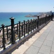
Albir's seafront promenade is notable for its Walk of Fame, which honours figures associated with the Alfàs del Pi Film Festival, held since 1989. Names such as Luis García Berlanga, Pedro Almodóvar, Verónica Forqué and Carmen Maura are commemorated in stone and bronze.
Just a few metres away, the pebble beach below Punta Bombarda invites visitors to swim or enjoy water sports. Construction work along the shoreline uncovered a necropolis, a mausoleum and a luxurious Roman villa. Today, the site can be explored as the Valencian Community's first open-air museum, a remarkable archaeological attraction overlooking the Mediterranean.
The route to the lighthouse: an easy walk with sea views
At the end of the promenade begins the park access road and, with it, the area's most popular route: the path to the lighthouse, also known as the red route. It covers around 5 km return along a paved track with very little difficulty and several viewpoints overlooking the Bay of Altea.
The route follows the former service road leading to the lighthouse, gradually gaining height as each bend reveals new panoramic views. Along the way, it passes cliffs shaped by erosion, where caves and natural arches emerge, including the Boca de la Balena (Whale's Mouth), a rock formation whose shape resembles the open jaw of a whale.
Geology on display
The Serra Gelada is composed largely of limestone and marl dating back to the Late Jurassic and Early Cretaceous periods. These ancient marine sediments are now exposed in the cliff faces.
Walking along the route is like following an open-air geology lesson. Folded rock layers, cavities and natural platforms reveal that the entire landscape once lay beneath the sea. The cliffs are also home to a significant seabird colony, making the area one of the most important sites for these species in the Valencian Community.
Dunes that climb the cliffs
Among the park's most remarkable features are the fossilised climbing dunes, which cling to the base of the cliffs and appear to ascend impossibly steep slopes.
Their origins date back to the last Ice Age, when lower sea levels exposed large sandbanks. Wind carried the sand towards the mountains, forcing it up the slopes. When sea levels later rose again, the dunes remained suspended against the rock face, leaving behind one of the most unusual geological formations on the Spanish coast.
Yellow route: the more demanding option
Visitors looking for a greater challenge can tackle the yellow route, which follows the ridge of the Serra Gelada from one end to the other along a dirt path.
This route includes exposed sections close to steep drops and should be attempted only with suitable hiking footwear, sufficient water, and careful planning. In return, walkers are rewarded with views over both bays and a unique perspective of the hanging dunes. As the route is linear, it is advisable to arrange transport back.
Mines, a defensive tower and a lighthouse turned museum
Towards the end of the lighthouse route, traces of the area's mining past become visible. The former Virgen del Carmen ochre mine left behind workers' dwellings, remains of transport infrastructure and pillars in the ravine where wagons once carried ore to the shore for loading onto barges.
Nearby, a former quarry has been converted into a recreational area featuring a short introductory via ferrata. The route culminates at the Bombarda Tower, part of the network of defensive towers built in the 16th century during the reign of Philip II to guard against Barbary pirate attacks, and at the lighthouse itself, constructed in 1863 and standing 112 metres above sea level. Today, the lighthouse houses an Interpretation Centre dedicated to maritime culture and the natural park.
Beneath the surface: hidden coves, islands and seagrass meadows
Experiencing the Serra Gelada solely from land reveals only a small part of its beauty. At sea, a series of coves adds another dimension to the landscape.
Amerador Cove, visible from the lighthouse, cannot be reached on foot. Metge Cove is best accessed by kayak, while Cala de la Mina, reached via a rocky path from a nearby turn-off, offers rocky seabeds perfect for snorkelling, although arriving by sea avoids the steep descent.
Five nearby ports offer boat excursions, including those departing from Benidorm, where visitors can reach Benidorm Island, the only one of the four islets open to public access. Access to the other islets is restricted to protect their ecosystems.
Diving and marine life
Beneath the water lies a network of Posidonia and Cymodocea seagrass meadows, which provide shelter for a diverse range of marine species, including the endangered fan mussel.
Illa Mitjana offers diving opportunities to depths of around 30 metres on its eastern side and approximately 15 metres on its western side. Whale and dolphin watching is also popular, thanks to a resident population of more than one hundred bottlenose dolphins.
The crystal-clear waters of the park's coves continue to attract snorkellers and low-impact boating enthusiasts, provided activities remain within the established environmental regulations.
Practical tips and basic rules for a successful visit
The combination of dramatic cliffs, accessible trails and pristine marine habitats makes the area ideal for a full day of exploration. To ensure a safe and responsible visit, keep the following recommendations in mind:
- Plan your start time to avoid the midday heat and carry enough water for the entire route.
- Wear appropriate footwear, even on the paved route, and take extra care near cliff-edge viewpoints.
- Follow park regulations: boating activities and anchoring are controlled to protect seagrass meadows and marine habitats.
- Avoid stepping on the marine seagrass when entering or leaving the water, and never remove sand, rocks or natural materials.
- If tackling the yellow route, plan your return and check weather conditions, as winds can be much stronger along the ridge.
Article seen in Spanish on viajes.nationalgeographic.com.es: The Alicante route that skirts cliffs and dunes between a lighthouse-museum, crystal coves and old mines